Why Spring TX Homes Are at Risk for Water Damage
Spring, Texas carries a severe flood risk score above 70% — a number that reflects not just the frequency of storms, but the specific combination of geography, climate, and soil conditions that make water damage events here more likely and more damaging than in most American cities. If you own a home in Spring, understanding these risk factors isn’t alarmism; it’s basic preparation.
In this post, we cover Spring’s documented flood history and climate data, how Harris County’s expansive clay soil creates a water damage risk that operates even between storm events, how these two factors interact in ways that surprise homeowners, and what you can do to reduce your exposure.
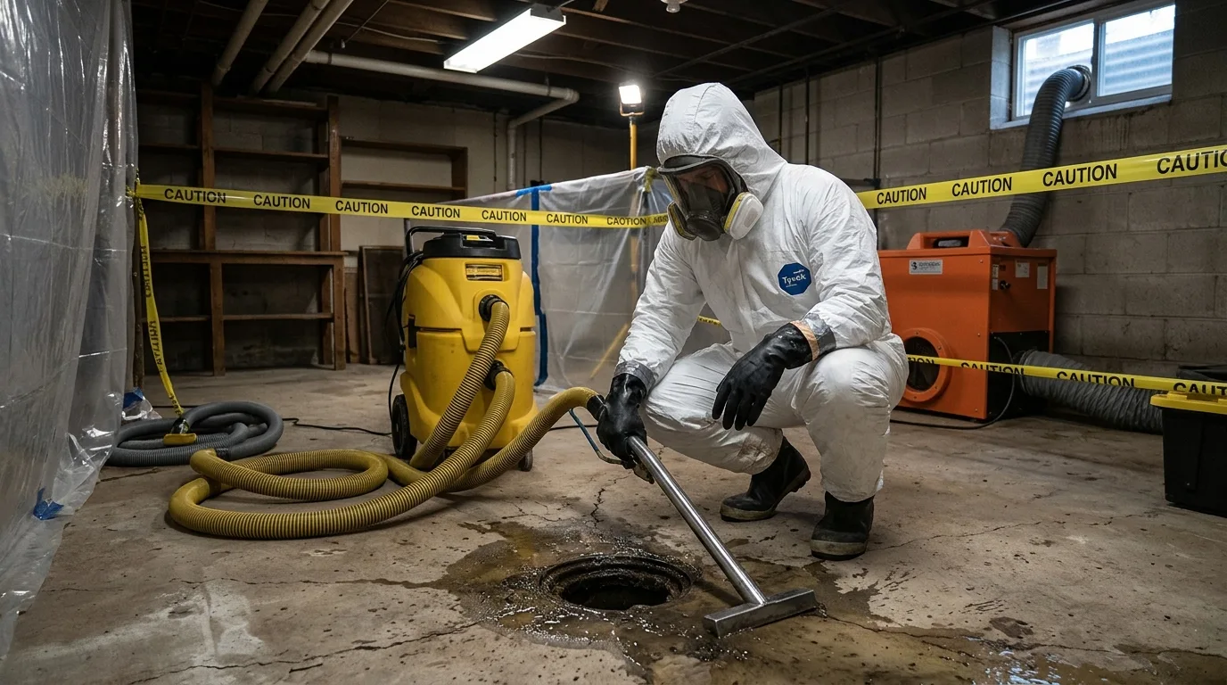
Spring TX Water Damage Response — 24/7
When water events strike in Spring, fast response is the difference between a $2,000 job and a $20,000 job. Call (877) 698-1311 immediately.
Spring TX’s Documented Flood Risk
Spring sits in a humid subtropical climate zone (Köppen Cfa) with average annual rainfall of approximately 50 inches — about double the U.S. national average of 26 inches. But the frequency isn’t the main issue. It’s the intensity.
Spring and the surrounding Houston metropolitan area experience repeated extreme rainfall events — events where large volumes of water fall in a short time, overwhelming drainage systems and causing rapid flash flooding. The Tax Day Flood of April 2016 dropped 17 inches of rain in parts of Harris County in a single day. Hurricane Harvey in August 2017 delivered over 50 inches of rain to some parts of the Houston area over four days, causing catastrophic flooding throughout Harris County. Tropical Storm Imelda in September 2019 produced record rainfall that again inundated Harris County neighborhoods.
These are not anomalies. They are the pattern of severe weather that defines living in Spring, Texas — which is why flood risk models rate Spring at severe flood risk, with more than 70% of properties at elevated risk over a standard ownership period.
How Spring’s Geography Amplifies Flood Risk
Spring’s flood risk isn’t just about rainfall volume. It’s about where the rain goes when it falls. Cypress Creek and Spring Creek both run through the Spring area and have defined floodplains that extend into residential neighborhoods. When major rainfall events raise creek levels, the floodplain neighborhoods — including areas near Old Town Spring and along I-45 — experience direct creek overflow flooding on top of whatever stormwater their drainage systems are managing.
Properties throughout Sterling Lakes, which were built around retention ponds, and Harper’s Preserve, with its proximity to I-45 storm drainage, face flooding dynamics that differ from the rest of Spring. Understanding whether your specific property is in a Special Flood Hazard Area along Cypress Creek or Spring Creek is important — it affects your flood insurance requirement, the permit process for any structural repairs, and the likelihood of direct floodwater entry versus storm drainage backup.
Not Sure About Your Flood Risk? We Can Help.
We assess Spring TX properties for flood and water intrusion risk. Call (877) 698-1311 or request a free assessment.
The Clay Soil Problem That Operates Between Storms
Spring’s storm risk gets most of the attention, but Harris County’s expansive clay soil creates a water damage pathway that works independently of storm events — and often surprises homeowners who thought they understood their risk.
The Beaumont clay formation underlies most of Harris County. This clay swells when wet — absorbing water and expanding with enough pressure to lift foundations — and shrinks when dry, creating voids beneath slabs and allowing soil to pull away from foundation walls. The cycle repeats every wet and dry season, and over years, it accumulates damage to foundations, pipes, and structural connections.
For Spring homeowners, the practical consequences include:
-
Slab leaks: Pipes embedded in concrete slabs are stressed by the foundation movement caused by clay expansion and contraction. Hairline cracks develop, then widen over time into leak points that introduce water into the slab and surrounding soil. Homes in Gleannloch Farms and Champion Forest — where mature landscaping creates additional soil moisture variation — see higher rates of slab leak failures.
-
Foundation cracks: As the foundation heaves and settles with clay moisture cycling, cracks develop that create pathways for surface water and soil moisture to enter the home. After a heavy rain event, these cracks can allow significant water intrusion even if the home is not in a floodplain.
-
Water intrusion from saturated soil: During and after major rainfall events, the surrounding clay soil becomes fully saturated and holds water against the foundation for weeks after the rain stops. This slow moisture source is different from flooding — there’s no visible standing water, just persistent dampness in crawl spaces, lower walls, and subfloor materials.
How Climate and Soil Interact
The most damaging water events in Spring are often the combination of both factors working together. A major storm event saturates the clay soil, raises groundwater levels, and brings flooding from Cypress Creek or storm drain backup simultaneously. The visible flooding is addressed by the homeowner — they see water on the floor and call for help. But the persistent moisture from the saturated clay continues for weeks after the floodwater recedes, introducing moisture against the foundation and into wall cavities that isn’t visible until mold growth, musty odors, or soft floors reveal the problem months later.
This is why comprehensive water damage restoration in Spring requires both fast emergency response and thorough moisture mapping of structural cavities — not just the areas where flooding was visible.
Practical Steps Spring Homeowners Can Take
Understanding your risk is the foundation, but action reduces it:
Know your floodplain status. Check FEMA’s flood map service for your specific address. If you’re in a Special Flood Hazard Area (Zone AE or X500 near Cypress Creek), flood insurance is essential — and may be required by your lender.
Document your home before storm season. Photograph every room, every appliance, and every structural element you can access before March and before June each year. This documentation is invaluable for insurance claims after storm events.
Learn where your water shutoff is. A burst pipe that you can shut off in 30 seconds does far less damage than one that runs for two hours while you search for the valve.
Address foundation cracks promptly. Small cracks in foundation walls create water intrusion pathways that worsen over time. Sealing them before storm season reduces the soil moisture intrusion risk specific to Harris County’s clay formation.
Respond to water events immediately. Every hour of delay after a water event — from any source — increases damage scope in Spring’s humid climate. Mold can begin growing within 24–48 hours here.
Frequently Asked Questions
How bad is Spring TX’s flood risk compared to other cities?
Spring’s flood risk rating of severe (70%+) places it among the highest-risk residential areas in Texas. For context, the national average flood risk score is significantly lower. Spring’s position within Harris County — which has historically been one of the most flood-prone counties in the United States — and the presence of both Cypress Creek and Spring Creek as local flood drivers make this rating well-supported. The Tax Day Flood and Hurricane Harvey are modern examples of what the risk profile predicts.
Does clay soil cause water damage even when it isn’t raining?
Yes. The expansive clay soil in Harris County holds moisture absorbed during wet periods for weeks or months, introducing slow and persistent moisture against foundations even during dry weather. Additionally, the shrink-swell cycle of clay movement stresses pipes and foundations continuously, creating failure points that can release water from within the home’s plumbing system independent of any exterior rainfall. See our detailed post on Harris County clay soil and foundation leaks for a full explanation.
What neighborhoods in Spring TX have the highest flood risk?
Properties adjacent to Cypress Creek and Spring Creek carry the highest direct flood risk from creek overflow events. Sterling Lakes (built around retention ponds), Harper’s Preserve (near I-45 drainage), and the Old Town Spring historic district (near original rail corridors and creek systems) face above-average risk. That said, the Tax Day Flood and Harvey flooded neighborhoods throughout Spring that had no prior flood history — extreme events overwhelm all drainage systems, not just the flood-mapped areas. Read our Spring TX flood history guide for neighborhood-specific event history.
Spring TX — Water Damage Restoration 24/7
Spring Water Damage Restoration responds within 60 minutes across Spring and Harris County. IICRC certified. Call (877) 698-1311.
Related: